5 Stanley Park Trails You Should Explore
The Seawall is one of Vancouver’s claims to fame. It provides a smooth path for walkers, joggers, strollers, rollerbladers, and cyclists to circumnavigate the city’s crown jewel, Stanley Park, while providing views from sunrise to sunset. However, there’s a whole lot to be explored and appreciated under the park’s 1,001 acre canopy so I’d love to introduce a few of our favourite trails which are a part of an elaborate, winding and scenic forest network.
5 Stanley Park Trails You Should Explore
Getting Started
Every Stanley Park trail is on Google Maps including Google Street Views so you can check out the paths before you go. I have marked five trails on the map below and while there are many others that connect (I have marked some feeder trails in light blue) I decided to start with these five because they’re a good introduction to the variety of terrain in the park.
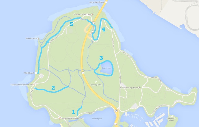
Recommended trails are marked. Other blue trails are optional feeder routes. All other trails in grey.
1. Cathedral Trail
Length: 280 meters from Lagoon Drive to Lees Trail
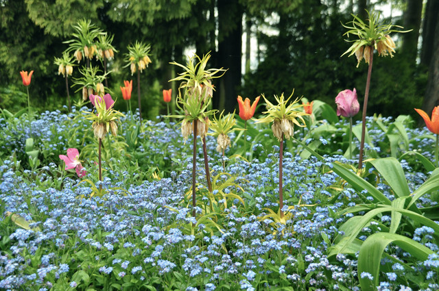
Location and Trail Features: The Cathedral Trail is a good starting point from Second Beach and Lost Lagoon. You can walk or cycle in along Lost Lagoon, or park at Second Beach, and enter the woods along Cathedral’s new boardwalk. This elevated trail allows for streams to flow underneath instead of cutting it off with a muddy gravel trail. It’s a nice new addition and a good way to start your trek.
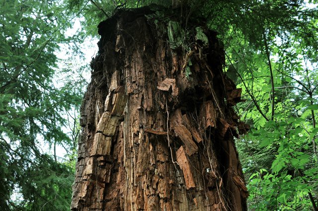
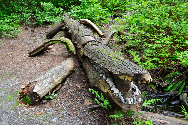
Along Cathedral you’ll find dozens of uprooted trees from the windstorm of 2006 (where gale-force winds reached 119km/h) and it’s fascinating to see how the forest has reclaimed them. There is a small pond with ducks, interpretive signs, and an alligator made of a fallen log that I believe has lost its shape in recent years (see photo below from 2011).
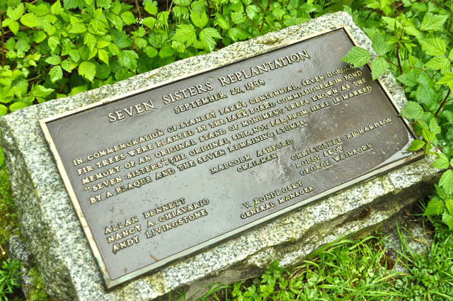
Cathedral leads you right to the spot of the Seven Sisters of Stanley Park before turning into the Bridle Path. You can turn around (making for a 10-15 minute round trip) or continue up Bridle which runs all the way up the park, parallel to the causeway, peaking at Prospect Point.
2. Lovers Walk
Length: 1km from Rawlings Trail to Bridle Path
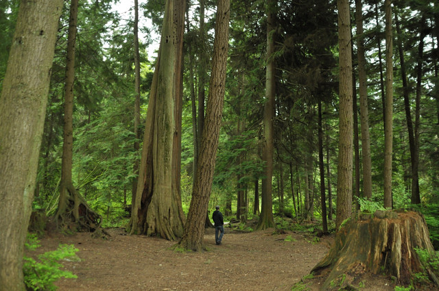
Location and Trail Features: Lovers isn’t a main trail that we take all the time but it’s a nice, wide connecting route with nurse logs, towering cedars, huckleberries, and no sound of traffic from the causeway piercing through like it does on some other forest trails. I also like lovers because of the two trees in the photo below, which look like they are embracing.
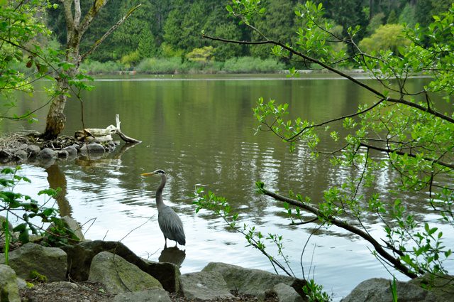
3. Beaver Lake
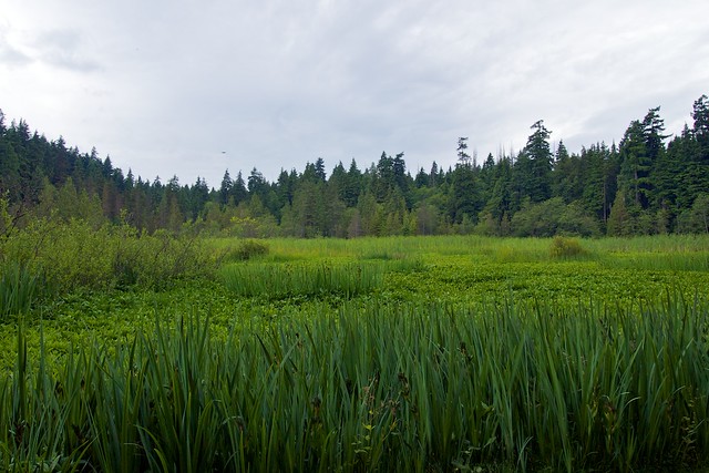
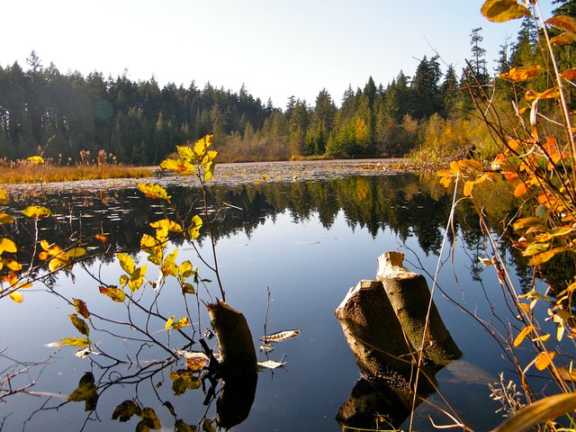
Location and Trail Features: You definitely have to use other trails to get to this one but Beaver Lake offers its own unique take on Stanley Park. Peel away from the evergreens, stumps, mulch, and ferns and enjoy this overgrown wetland with and ducks passing through. While lush and green in spring and summer, I love Beaver Lake in the fall when the foliage starts to change for the season and the brush parts to reveal the open water.
4. Avison Trail
Length: 1km from the Seawall to Prospect Point
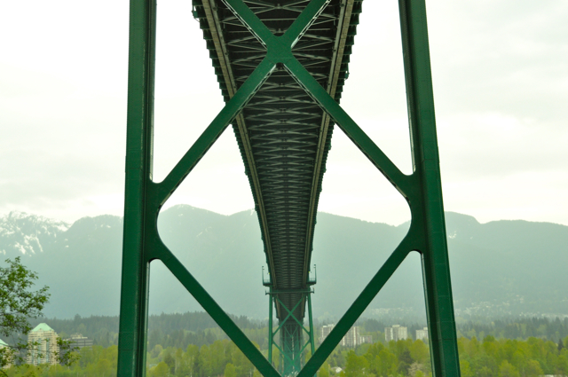
Location and Features: Avison is a nice little diversion from the Seawall but be aware, it is almost all uphill as it leads you from sea level, under the Lions Gate Bridge, and all the way up to Prospect Point. It gives you some unique views, like that of the bridge’s underbelly, and if you’re in need of an emergency ice cream cone you’ll find it at the Prospect Point Cafe, a nice reward at the top of the trail.
Avison Trail Namesake: Henry Avison, Stanley Park Superintendent 1888-1895, the first employee of the Vancouver Park Board. He cut Stanley Park’s first trails and was its first zoo keeper, designed the park’s first gardens, and lived in a lodge by its entrance.

5. Merilees Trail
Length: 1.8km Stanley Park Drive near Prospect Point to Third Beach
Location and Features: You can either enter the Merilees Trail from the bottom at Third Beach, or from two places up top along Stanley Park Drive just south of Prospect Point. The Merilees Trail is lined with lush leafy greenery, flowers, and berry bushes that have all found their way to the sunlight after the big wind storm of 2006 clearcut the area. Depending which way you enter the trail, you’ll have a steep climb or a steep decline on loose gravel so pay attention to your footing.
There are some picnic tables that get a lot of sunlight during the day and that lookout over the water, which make for a nice pit stop. Merilees also splits off into the Siwash Rock Trail, which is a worthy diversion thanks to the beautiful lookout on the cliff in front of the actual Siwash Rock. You’ll be high above the Seawall, looking out at West Vancouver, English Bay, Point Grey and Kitsilano.
Merilees Trail namesake: Harold Merilees. General Manager of Tourism Vancouver in the 1960s and was known as “Vancouver’s first great ad man”.
Read more! 3 More Trails to Explore + 4 More Trails to Explore in Stanley Park.
*use at your own risk