
False Creek Flats
False Creek today flows in and out of English Bay, ending with the waterfront walkway at Science World. In the early days, through grasslands and a network of creeks and streams, False Creek soaked all the way back to where Clark Drive runs now.
False Creek Flats
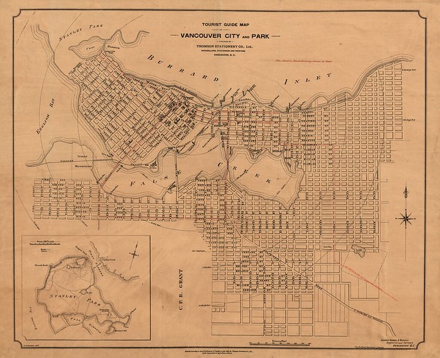
1898 – Vancouver City and Park Tourist Map. Archives Map 35.
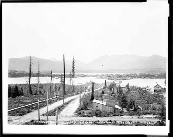
1890 – View looking north on Main from 7th Ave before the fill. VPL Number: 36.
Photographer: H.T. Devine.
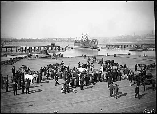
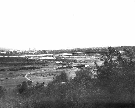
1908 – South side of False Creek looking at the Main Street Bridge. VPL Number: 4989.
Photographer: Philip Timms.
The False Creek back-fill began around the time of the first World War, with railways and roads from New Westminster to Vancouver being the top priorities. Main Street, the route from New Westminster that came down from Kingsway, had a bridge across the flats. When the train station was built even more of the creek was filled in.

1917 – Canadian Northern Railway train shed. Archives Item# Bu N540.063.

1918 – CNR Station under construction (right) and completed GNR (Union) Station (left).
Archives Item #: PAN N178. Photographer: Canadian Photo Co.

1918 – Final stages of construction before fill of False Creek completed.
Archives Item #: Bu N540.077.

1932 – Exterior of the Canadian National Railway station. Archives Item #: Can P23.1.
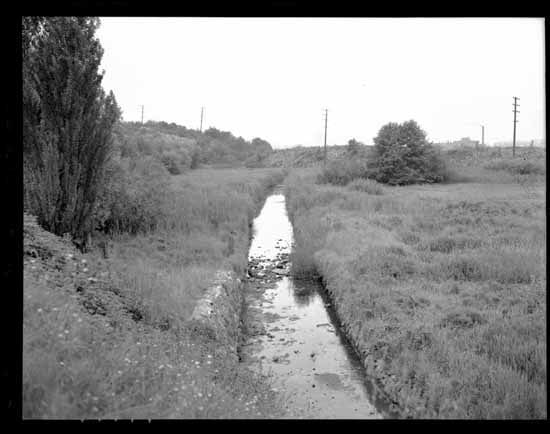
The stream network remained for several more decades until a tunnel project began, re-routing major East Vancouver tributaries, like China Creek and Brewery Creek, underground.
Try to imagine, underneath streets of East Vancouver, a small river, with at least eight major tributaries, pulsing nutrient-bearing salmon in ancient cycles throughout a vast area of forest and marsh bounded by East 41st on the south, Grandview Highway on the north, and the hill country around Victoria Drive on the east.
The little river ended up with the delicate-sounding name of China Creek, and its estuary used to be in the vicinity of Great Northern Way and Clark Drive. Back then there was a broad, shallow arm of the sea where the railyards are now. Terminal Avenue runs through the middle of a place that was once watery and alive with sturgeon, oolichan, flounder, salmon, crab, mussels, and clams. [Georgia Straight]
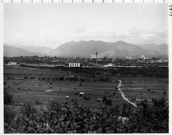
1935-1936 – Rooftop view looking North over False Creek flats. VPL Number: 7917.
Photographer: Leonard Frank.
1935-1936 – Rooftop view looking North over False Creek flats. VPL Number: 7918.
Photographer: Leonard Frank.
The False Creek Flats turned into industrial land and also contained a landfill near the China Creek area until the 1930s.
August 21, 1938: The Province published a letter to the editor from one signed Waterfront: “Sir: Why is there all this fuss and trouble about the garbage dump on False Creek Flats? I fail to see how anyone can approve discharge of refuse in the heart of the city, even if it is in an industrial area. There are thousands of people living close to the flats and this ill-smelling property is at their very back doors. Why does Vancouver fail to follow the example of many large eastern cities which tow their garbage out to sea and dump it? … Let’s see if our garbage can’t be dumped far out in the Gulf of Georgia. That’s where it belongs.” [Vancouver History]
1960s – False Creek flatlands. VPL Number: 42026. Photographer: Province Newspaper.
Among the snaking rail lines, box-shaped warehouses, the viaducts and the SkyTrain line, residential development is happening in a few key areas along with growth on Great Northern Way. They’re still the “False Creek Flats” and the future of the area in general is almost constantly up for discussion.


3 Comments — Comments Are Closed
Thank you for posting a story on an often overlooked part of the city, which not only has a fascinating history, but as the last parcel of largely undeveloped land, in an area of increasing density, its future will continue to be hotly debated by council and residents. As an interesting aside, in the first 1935-36 photo with the grazing cows you can see the new Canada Packers Ltd slaughterhouse in the background (chimney) which is still in use today as a storage locker facility and, oddly enough, an animal hospital.
The False Creek infill is arguably the greatest geographical change that the city has ever experienced. It was once discussed filling in the whole creek to about where the Granville Island area is today because people thought it would be of better use as land. Of course developers today if they could go back in time would like to carve out the whole creek all the way to Clark Drive. The attraction of being able to sell Waterfront condo’s all the way up the creek would be too tantalizing of an idea for them to be sure.
The False Creek infill plans go back to about 1905, and work had already begun indeed before the first world war.
I’m not sure about the situation with groundwater today, but I recall hearing when we’d get a few good rainfalls, the basement of the Pacific train station would still have some leakage issues. The whole thing as you can see was practically a swamp at one time.
I had just recently walked in Portside Park where there is a city plaque titled LuckLucky denoting the history of that area and mentioning the slew/creek that once connected Vancouver Harbour to False Creek. The first nations called that area the Grove of Beautiful Trees,…wished I could’ve seen that.